I get vertigo just watching this video.
The pathway is called Caminito del Rey, which means the King's Little Pathway. The king in question is Alfonso XIII of Spain, who walked the path in 1921.
The path was finished in 1905, to be used by workers who were building a hydroelectric plant.
For more details of the pathway see here , here and here
Showing posts with label Travel. Show all posts
Showing posts with label Travel. Show all posts
Saturday, April 9, 2011


Saturday, July 18, 2009
Our China Trip
Introduction
Margaret and I flew out of Australia on 10th June, 2009 and arrived back on 7th July, 2009.
First of all some links:
General photos here
Here is the slide show:
Photos of people, mainly those in our tour group, here .
My Google Map of our trip:
View China Tour Map in a larger map
(Use the + or - buttons, at top left, to zoom in or out. Move the map by dragging or use the arrow keys at top left. Click on the Sat button at top right to see a Google Earth version. Click on the China Tour Map link to go to the map in Google Maps.)
Margaret and I flew out of Australia on 10th June, 2009 and arrived back on 7th July, 2009.
First of all some links:
General photos here
Here is the slide show:
Photos of people, mainly those in our tour group, here .
My Google Map of our trip:
View China Tour Map in a larger map
(Use the + or - buttons, at top left, to zoom in or out. Move the map by dragging or use the arrow keys at top left. Click on the Sat button at top right to see a Google Earth version. Click on the China Tour Map link to go to the map in Google Maps.)
Friday, July 17, 2009
Our China Trip - the summary
This summary was provided by our incomparable guide - Andi.
Seven Cruises
One Train Trip
Five Long Bus Trips
Four Internal Plane Flights
It is difficult to quantify the distance some of our travelling - bus trips around the cities and to sites outside the cities - but such travel would add up to 200 to 300 kms.
This would mean a grand total of our travelling within China between 7,000 and 7,500 kms.
Seven of the Largest, Longest or Fastest in the World
Eight Sites of World Historical and Cultural Heritage
Seven Cruises
- Three Gorges of Yangtze River
- Sheng Nong Stream
- Erhai Lake in Dali
- Li River in Guilin
- Grand Canal in Suzhou
- West Lake in Hangzhou
- Huang Pu River in Shanghai
One Train Trip
Beijing to Xi'an | 1200 kms |
Five Long Bus Trips
Wuhan to Yichang | 380 kms |
Kunming to Dali (and return) | 320 kms each way |
Shanghai to Suzhou | 80 kms |
Suzhou to Hangzhou | 180 kms |
Hangzhou to Shanghai | 200 kms |
Total | 1480 kms |
Four Internal Plane Flights
Xi'An to Wuhan | 1040 kms |
Chongqing to Kunming | 860 kms |
Kunming to Guilin | 900 kms |
Guilin to Shanghai | 1395 kms |
Total | 4195 |
It is difficult to quantify the distance some of our travelling - bus trips around the cities and to sites outside the cities - but such travel would add up to 200 to 300 kms.
This would mean a grand total of our travelling within China between 7,000 and 7,500 kms.
Seven of the Largest, Longest or Fastest in the World
| Tiananmen Square | 44 hectares |
Tomb of Emperor Qin | 56 kms2 |
Forbidden City | 72 hectares |
Maglev Train | 431 km/h |
Grand Canal | 1747 km |
Great Wall | |
Three Gorges Dam |
Eight Sites of World Historical and Cultural Heritage
- Forbidden City
- Temple of Heaven
- Great Wall
- Summer Palace
- Master of Nets Garden
- Humble Administrator's Garden
- Stone Forest
- Museum of Terracotta Warriors
Thursday, April 2, 2009
The Manera
Our friends, and neighbours, David and Glenda Horne, own a boat. the Manera that is moored at Yaringa Marina on Westernport Bay.
Yesterday we travelled to join them on the boat.
This post is quite long, so if you just want to view the photos follow this link.
The map below shows the location of the Marina (the place mark at the top). The map can be operated like a normal Google Map, but it is probably better to click on the View Larger Map link at the bottom. If you choose the Satellite option and zoom in as far as possible the place mark is pointing at the Manera.
View Larger Map
Thursday morning dawned bright and fine ...
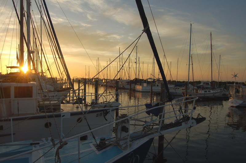
Unfortunately, I didn't take many pictures of the interior, but the photos on this link clearly show that there is plenty of room down below, in a Swanson 42.
With Glenda at the helm we gently motored out of the marina. Westernport is very tidal, and we could only access the deeper water via channels. Sailing times are not determined by the whim of the captain, but by the requirements of the tide. We left at 9:20 am to ensure that our boat, with a draft of 1.8 metres could negotiate the two shallow places in the channel. David and Glenda discovered this once when sailing, getting firmly stuck on one of the shallow places. Although they spent a worrying couple of hours, they learned important information about the characteristics of the Manera on that occasion. The tide was still receding when they stuck fast, and after a while the boat rapidly tilted over to a 45 degree angle. Some boats do not recover well from such a predicament, but happily as the tide started rising, some hours later, the boat quickly righted itself.
When we finally cleared the channel, after about one nautical mile, David and his friend Jim, raised the sails. The Manera has a cutter rig, meaning that it has one mast, a mainsail, and can have two headsails set. We sailed with only the mainsail and one headsail.
I will try to use technical, nautical terms so the diagram below might be of help in deciphering my descriptions.
Another useful reference is this Wikipedia article.
The mainsail is raised using a rope called the main halyard.
The headsail is furled (wound) around the forestay, which is a piece of standing rigging which keeps a mast from falling backwards. It is attached to the top of the mast, at one end and to the bow of the boat at the other.
Before we left the marina, David had attached two ropes, called the headsail sheets, to the free corner of the headsail, the clew. These sheets were run through pulleys back to the cockpit, where the helm is located. David pulled the leeward sheet using a winch to set the headsail into position.
For a while the wind was too light for the sails to provide forward motion, though the water though the tide was moving us, slowly, in reference to the bottom of the bay. After a few minutes Glenda gave over the helm to Jim, a friend who lives on his boat at the marina. Jim is an experienced sailor, having participated in the >Sydney-Hobart race.
David and Glenda have also has experience in blue water sailing. They purchased the Manera in Brisbane and sailed the boat back to Victoria, with the help of Jim and a few other friends. They have also sailed her to from Western Port to Wilson's Promontory.
After Jim had sailed the boat for a while I took over the helm. This task is not quite as easy as it seems, as there are a range of issues to be considered.
An appropriate heading has to be determined. It is not always possible to go directly to the destination - the wind might be blowing from an inappropriate quarter, and shallow water has to be avoided. One method of keeping on the chosen heading is to pick out a landmark in the right direction and sail towards it. There are also instruments available to assist in maintaining the heading. The Manera has three of them, the compass at the helm, and electronic compass as shown at left in the photo below ...
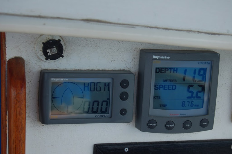
... and the chart plotter, below.

The chart plotter provides a great deal of information. The black oval shape near the bottom of the screen is the location of the boat. The heading can be seen (on the right) as 357 degrees (this photograph was taken while we were returning to the marina). The green line shows the heading graphically and the blue line with arrow is the direction of the tide. The boat's speed of 7.4 nautical miles is a combination of speed through water and the tide. The white areas signify deeper water, the shallow blue areas should be avoided.
The depth of the water can be monitored in two ways. The first is via the depth meter next to the electronic compass the second is by using the chart plotter.
The third issue to be monitored was brought home to me when Jim cautioned me to watch the wind direction which was heading around aft, and which could cause an unintentional gybe. The definition of a gybe (or jibe) below is taken from this site.
As a result of Jim's comment I adjusted the heading a little to port (the left). An instrument is available to determine the direction of the wind, relative to the boat. It is shown to the right of the clock in the photo below.

The photograph was taken on our return trip, when we were using the motor rather than the sails. At the time of the photograph, the wind was coming from about 15 degrees to starboard. When I took over the helm the ideal direction of the wind was 120 degrees on the port side. After Jim's warning I carefully watched the wind direction.
As well as heading, depth of water and wind direction, the person at the helm must regularly scan the water for other vessels.
About 10 or 15 minutes after I took over the helm we started to approach the shallower water (as indicated by the chart plotter) and a change of heading was required. As we were reaching, in fact close to a broad reach, the appropriate manoeuvre was a gybe (described above).
Jim adjusted the main sheet to make sure that the boom did not come across too fast. Then David loosened the starboard headsail sheet (from the winch) and after I turned the helm to starboard, Jim pulled in the port headsail sheet, until the sail was positioned and drawing air on the port side. While all of this was going on, the main automatically changed from starboard to port.
We sailed for a while toward Lysart's pier and then gybed back to port.
We then sailed on passing French Island to port and the Mornington Peninsula to starboard, with me at the helm ...

and, Frankie ...
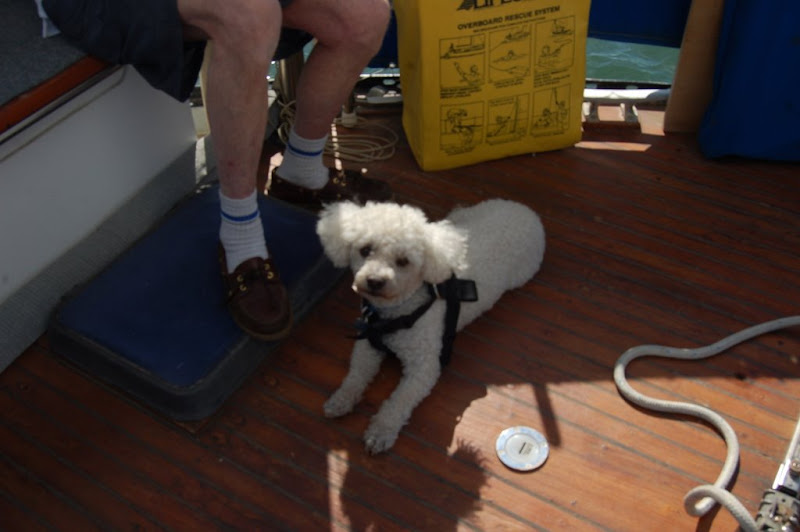
... Glenda ...

... Margaret ...
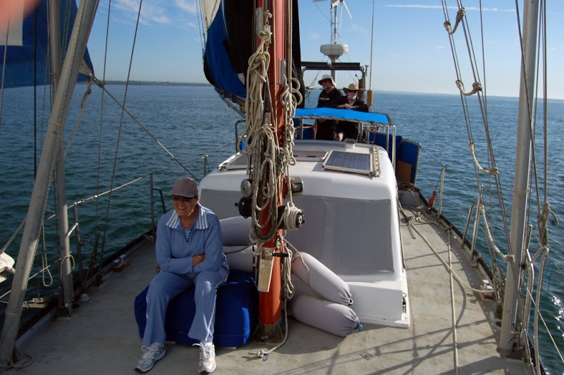
... Jim ...
... and David ...
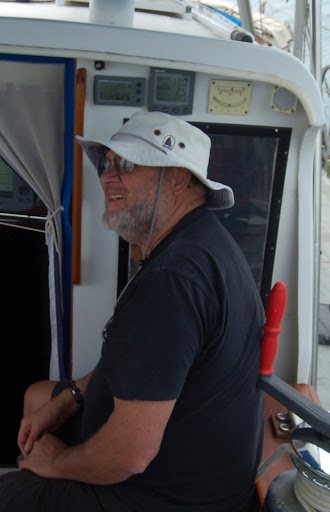
... chilling.
A mile of so east of Cowes, on Philip Island, we noticed one of the Bass Straight oil platforms moored near the shore. A few hundred metres off Cowes we decided that we had travelled far enough to the south and decided to turn start our return to the marina. This time the appropriate turn was a tack. This involves turning the boat through the wind. It is important to have plenty of speed before performing a tack, as part of the way through the procedure, the boat looses power as it is pointing directly into the wind.
I turned the helm hard to starboard, and David and Jim started to move the headsail from port to starboard. Just after we had passed the half way point, they held the headsail in only part of the way across to get wind into it as quickly as possible so we could complete the turn as quickly. Then they secured the sail to its new position on the port side. Naturally the mainsail moved across automatically.
We took a heading reasonably close to the wind (close hauled), with the sails trimmed in fairly tightly. This was to avoid excessive rolling as Glenda was below preparing lunch - hot crossed buns and watermelon.
While we were sailing between Mornington Peninsula and French Island, we heard a radio communication with the ship Iron Monarch. Looking around we could see the ship a couple of miles aft. It was travelling much faster than we were and relatively soon it caught up to us and passed us. We kept out of its way, which was fairly easy as it had to stay in the channel.
Soon after we noticed that we were on a potential collision course with a trimaran. We watched the boat closely. We had the right of way as we were on starboard tack and he was on port tack, but not all sailors take notice of the rules. Happily the trimaran sailor did know the rules as he changed direction to pass aft of us.
The wind was coming from the direction we needed to go, so we were sailing close hauled, close to the wind, but not making much headway as the wind was dying. Consequently, we took down the sails and started motoring. There are not many landmarks in the northern section of Westernport, which would make for difficulties in finding the channel to the marina, if it were not for the fact that it was clearly marked on the chart plotter.
I was still at the helm, when David and Jim started a conversation about araldite. I suspected that it was about me, which was confirmed when they explained that someone who does not easily give up the helm is called Captain Alaldite. This has become my nickname according to David.
Six hours after leaving we arrived back at the marina. After a peaceful few hours on deck, a pleasant dinner, Margaret and I headed home into the sunset ...
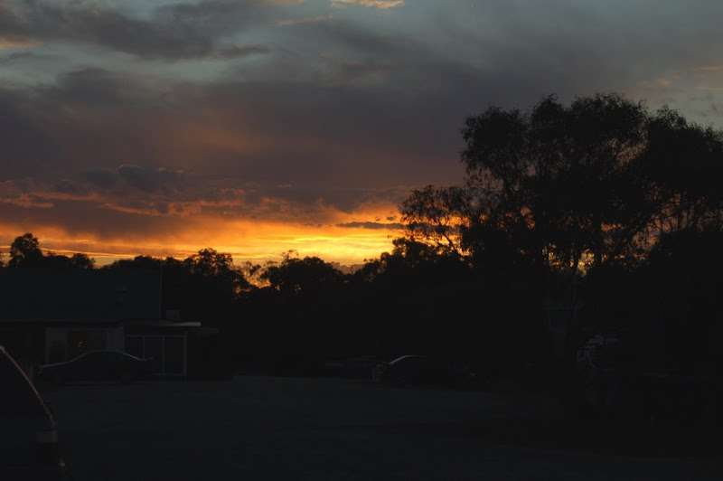
... while Glenda and David stayed another couple of days on the yacht.
Yesterday we travelled to join them on the boat.
This post is quite long, so if you just want to view the photos follow this link.
The map below shows the location of the Marina (the place mark at the top). The map can be operated like a normal Google Map, but it is probably better to click on the View Larger Map link at the bottom. If you choose the Satellite option and zoom in as far as possible the place mark is pointing at the Manera.
View Larger Map
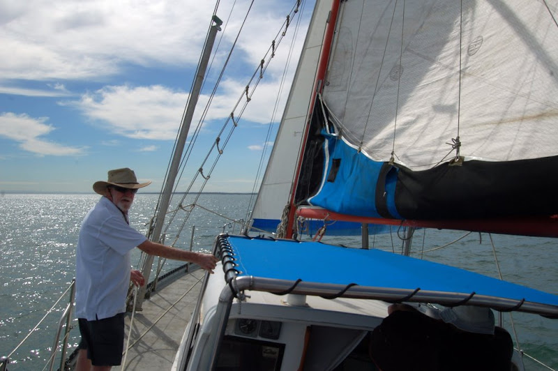
 | We arrived after dark, boarded, and walked down the fore deck shown in the photo.
|
Thursday morning dawned bright and fine ...
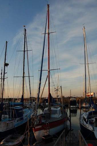 | ... giving us a clearer view of the boat. |
Unfortunately, I didn't take many pictures of the interior, but the photos on this link clearly show that there is plenty of room down below, in a Swanson 42.
| After checking over the boat, which included the rigging as can be seen in the photograph, David and Glenda manoeuvred the yacht from its tight berth into the main channel of the marina. This required some magic with ropes and at the helm.
| 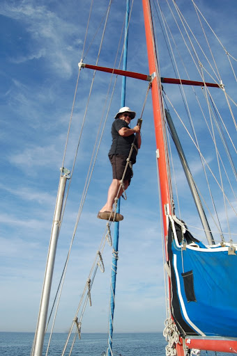 |
With Glenda at the helm we gently motored out of the marina. Westernport is very tidal, and we could only access the deeper water via channels. Sailing times are not determined by the whim of the captain, but by the requirements of the tide. We left at 9:20 am to ensure that our boat, with a draft of 1.8 metres could negotiate the two shallow places in the channel. David and Glenda discovered this once when sailing, getting firmly stuck on one of the shallow places. Although they spent a worrying couple of hours, they learned important information about the characteristics of the Manera on that occasion. The tide was still receding when they stuck fast, and after a while the boat rapidly tilted over to a 45 degree angle. Some boats do not recover well from such a predicament, but happily as the tide started rising, some hours later, the boat quickly righted itself.
When we finally cleared the channel, after about one nautical mile, David and his friend Jim, raised the sails. The Manera has a cutter rig, meaning that it has one mast, a mainsail, and can have two headsails set. We sailed with only the mainsail and one headsail.
I will try to use technical, nautical terms so the diagram below might be of help in deciphering my descriptions.
 | 1 main sail |
Another useful reference is this Wikipedia article.
The mainsail is raised using a rope called the main halyard.
The headsail is furled (wound) around the forestay, which is a piece of standing rigging which keeps a mast from falling backwards. It is attached to the top of the mast, at one end and to the bow of the boat at the other.
Before we left the marina, David had attached two ropes, called the headsail sheets, to the free corner of the headsail, the clew. These sheets were run through pulleys back to the cockpit, where the helm is located. David pulled the leeward sheet using a winch to set the headsail into position.
For a while the wind was too light for the sails to provide forward motion, though the water though the tide was moving us, slowly, in reference to the bottom of the bay. After a few minutes Glenda gave over the helm to Jim, a friend who lives on his boat at the marina. Jim is an experienced sailor, having participated in the >Sydney-Hobart race.
David and Glenda have also has experience in blue water sailing. They purchased the Manera in Brisbane and sailed the boat back to Victoria, with the help of Jim and a few other friends. They have also sailed her to from Western Port to Wilson's Promontory.
After Jim had sailed the boat for a while I took over the helm. This task is not quite as easy as it seems, as there are a range of issues to be considered.
An appropriate heading has to be determined. It is not always possible to go directly to the destination - the wind might be blowing from an inappropriate quarter, and shallow water has to be avoided. One method of keeping on the chosen heading is to pick out a landmark in the right direction and sail towards it. There are also instruments available to assist in maintaining the heading. The Manera has three of them, the compass at the helm, and electronic compass as shown at left in the photo below ...
... and the chart plotter, below.

The chart plotter provides a great deal of information. The black oval shape near the bottom of the screen is the location of the boat. The heading can be seen (on the right) as 357 degrees (this photograph was taken while we were returning to the marina). The green line shows the heading graphically and the blue line with arrow is the direction of the tide. The boat's speed of 7.4 nautical miles is a combination of speed through water and the tide. The white areas signify deeper water, the shallow blue areas should be avoided.
The depth of the water can be monitored in two ways. The first is via the depth meter next to the electronic compass the second is by using the chart plotter.
The third issue to be monitored was brought home to me when Jim cautioned me to watch the wind direction which was heading around aft, and which could cause an unintentional gybe. The definition of a gybe (or jibe) below is taken from this site.
A jibe or gybe is a sailing maneuver where a sailing vessel turns its stern through the wind, such that the wind direction changes from one side of the boat to the other. ... In this maneuver the mainsail will cross the center of the boat while the jib (foresail) is pulled to the other side of the boat.
As a result of Jim's comment I adjusted the heading a little to port (the left). An instrument is available to determine the direction of the wind, relative to the boat. It is shown to the right of the clock in the photo below.

The photograph was taken on our return trip, when we were using the motor rather than the sails. At the time of the photograph, the wind was coming from about 15 degrees to starboard. When I took over the helm the ideal direction of the wind was 120 degrees on the port side. After Jim's warning I carefully watched the wind direction.
As well as heading, depth of water and wind direction, the person at the helm must regularly scan the water for other vessels.
About 10 or 15 minutes after I took over the helm we started to approach the shallower water (as indicated by the chart plotter) and a change of heading was required. As we were reaching, in fact close to a broad reach, the appropriate manoeuvre was a gybe (described above).
Jim adjusted the main sheet to make sure that the boom did not come across too fast. Then David loosened the starboard headsail sheet (from the winch) and after I turned the helm to starboard, Jim pulled in the port headsail sheet, until the sail was positioned and drawing air on the port side. While all of this was going on, the main automatically changed from starboard to port.
We sailed for a while toward Lysart's pier and then gybed back to port.
We then sailed on passing French Island to port and the Mornington Peninsula to starboard, with me at the helm ...

and, Frankie ...
... Glenda ...

... Margaret ...
... Jim ...
... and David ...
... chilling.
A mile of so east of Cowes, on Philip Island, we noticed one of the Bass Straight oil platforms moored near the shore. A few hundred metres off Cowes we decided that we had travelled far enough to the south and decided to turn start our return to the marina. This time the appropriate turn was a tack. This involves turning the boat through the wind. It is important to have plenty of speed before performing a tack, as part of the way through the procedure, the boat looses power as it is pointing directly into the wind.
I turned the helm hard to starboard, and David and Jim started to move the headsail from port to starboard. Just after we had passed the half way point, they held the headsail in only part of the way across to get wind into it as quickly as possible so we could complete the turn as quickly. Then they secured the sail to its new position on the port side. Naturally the mainsail moved across automatically.
We took a heading reasonably close to the wind (close hauled), with the sails trimmed in fairly tightly. This was to avoid excessive rolling as Glenda was below preparing lunch - hot crossed buns and watermelon.
While we were sailing between Mornington Peninsula and French Island, we heard a radio communication with the ship Iron Monarch. Looking around we could see the ship a couple of miles aft. It was travelling much faster than we were and relatively soon it caught up to us and passed us. We kept out of its way, which was fairly easy as it had to stay in the channel.
Soon after we noticed that we were on a potential collision course with a trimaran. We watched the boat closely. We had the right of way as we were on starboard tack and he was on port tack, but not all sailors take notice of the rules. Happily the trimaran sailor did know the rules as he changed direction to pass aft of us.
The wind was coming from the direction we needed to go, so we were sailing close hauled, close to the wind, but not making much headway as the wind was dying. Consequently, we took down the sails and started motoring. There are not many landmarks in the northern section of Westernport, which would make for difficulties in finding the channel to the marina, if it were not for the fact that it was clearly marked on the chart plotter.
I was still at the helm, when David and Jim started a conversation about araldite. I suspected that it was about me, which was confirmed when they explained that someone who does not easily give up the helm is called Captain Alaldite. This has become my nickname according to David.
Six hours after leaving we arrived back at the marina. After a peaceful few hours on deck, a pleasant dinner, Margaret and I headed home into the sunset ...
... while Glenda and David stayed another couple of days on the yacht.
Thursday, February 5, 2009
Istanbul photo contest
During our trip to Europe last June we visited many iconic European cities. Our favourite surprised us though; it was Istanbul.
It is a fantastic freewheeling city a mesmerising mix of East and West.
It is also wonderfully photogenic.
I was happy with some of the photos that I took there, but none came close to the stunner below:

It is the winner in the Istanbul Photo Contest of 2008.
Here are a few of my Istanbul photos. Sadly no comparison.

Inside the Blue Mosque.

Saint Sophia surrounded by the bustling city.

Margaret shopping in the Grand Bazaar.
It is a fantastic freewheeling city a mesmerising mix of East and West.
It is also wonderfully photogenic.
I was happy with some of the photos that I took there, but none came close to the stunner below:
It is the winner in the Istanbul Photo Contest of 2008.
Here are a few of my Istanbul photos. Sadly no comparison.
Inside the Blue Mosque.
Saint Sophia surrounded by the bustling city.
Margaret shopping in the Grand Bazaar.
Wednesday, June 4, 2008
Europe 08 Heidelberg
The ship departed from Ruedesheim at 5:00 am and arrived in Mainz at 8:00 am.
We had a choice of destinations today. We could have stayed with the ship and toured Mainz, with the highlight the Gutenberg museum, then a cruise to Frankfurt and a tour of that town.
Instead we decided on the trip to Heidelberg. We made this choice a few days ago, on the basis that we would be on the ship for three weeks and it would be valuable to travel away from the rivers when possible.
The bus ride to Heidelberg took 90 minutes along an autobahn - which was similar to Australian freeways.
Heidelberg is not on the Rhine, its river is the Neckar. Like many of the cities and towns we visited, the history of the town goes back to Roman times, with a fort built in 40 AD. The city though is first mentioned in a document dated to 1196. This is considered the founding date for Heidelberg.
The most famous "sight" at Heidelberg is the Castle, or maybe the ruin of the castle. Victor Hugo summarised its history as follows:
Source this site.
We toured the castle, as usual, high on a hill overlooking the city. As it is largely ruined we mainly inspected the exterior walls, some of which contained many statues. The cellar has survived and is the site of the large wine vat called the Heidelberg Tun. The vat is huge and has a capacity of approximately 220,00 litres.
It is a beautiful and picturesque city that was not bombed during the Second World War. It was probably spared as it was not an industrial city and did not have an important transport hub.
We toured the older portion of the town, seeing part of the famous University, founded in 1386. We walked the Haupstrasse, the main pedestrian walk and had lunch in a restaurant with a view to the castle. We ate a local specialty food called maultaschen. The linked article describes them accurately as:
We quite enjoyed them. The photograph shows Margaret across the road from the restaurant, with the castle in the background.
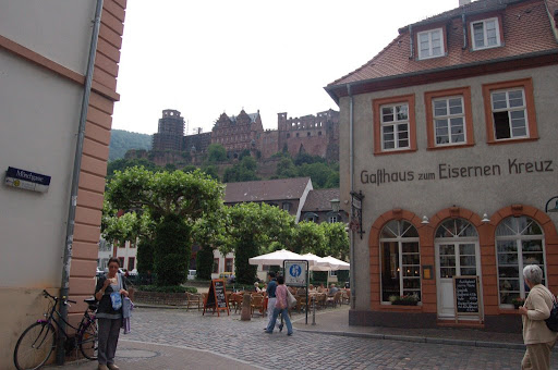
We returned to the ship (which was now in Frankfurt) through the first rain of the trip. Although there was a little time to tour Frankfurt we stayed on the ship for four reasons: light rain was still falling, we were told that it was a modern city and not really interesting, we were tired from our trip to Heidelberg and it was pleasant to sit in the ships lounge comparing notes with other travelers.
We had a choice of destinations today. We could have stayed with the ship and toured Mainz, with the highlight the Gutenberg museum, then a cruise to Frankfurt and a tour of that town.
Instead we decided on the trip to Heidelberg. We made this choice a few days ago, on the basis that we would be on the ship for three weeks and it would be valuable to travel away from the rivers when possible.
The bus ride to Heidelberg took 90 minutes along an autobahn - which was similar to Australian freeways.
Heidelberg is not on the Rhine, its river is the Neckar. Like many of the cities and towns we visited, the history of the town goes back to Roman times, with a fort built in 40 AD. The city though is first mentioned in a document dated to 1196. This is considered the founding date for Heidelberg.
The most famous "sight" at Heidelberg is the Castle, or maybe the ruin of the castle. Victor Hugo summarised its history as follows:
In 1619, Frederick V, then a young man, took the crown of the kings of Bohemia, against the will of the emperor, and in 1687, the Philip William, Count Palatine, by then an old man, assumes the title of prince-elector, against the will of the king of France. This was to cause Heidelberg battles and never-ending tribuluations, the Thirty Years War, Gustav Adolfs Ruhmesblatt and finally the War of the Grand Alliance, the Turennes mission. All of these terrible events have blighted the castle. Three emperors, Louis the Bavarian, Adolf of Nassau, and Leopold of Austria, have laid siege to it; Pio II condemned it; Louis XIV wreaked havoc on it.
Source this site.
We toured the castle, as usual, high on a hill overlooking the city. As it is largely ruined we mainly inspected the exterior walls, some of which contained many statues. The cellar has survived and is the site of the large wine vat called the Heidelberg Tun. The vat is huge and has a capacity of approximately 220,00 litres.
It is a beautiful and picturesque city that was not bombed during the Second World War. It was probably spared as it was not an industrial city and did not have an important transport hub.
We toured the older portion of the town, seeing part of the famous University, founded in 1386. We walked the Haupstrasse, the main pedestrian walk and had lunch in a restaurant with a view to the castle. We ate a local specialty food called maultaschen. The linked article describes them accurately as:
a Swabian Baden-Württemberg specialty food, consisting of an outer layer of pasta minced meat spinach, bread crumbs and onions and flavoured with various spices. Their appearance is similar to Italian ravioli but larger, each Maultasche being about 8-12cm across.Maultaschen are rumored to have been invented by monks of the Maulbronn monastery to conceal the fact that they were eating meat during lent. This is reflected in the semi-humorous alternative Swabian name "Herrgottsbscheißerle" (roughly: little ones who cheat the Lord).
We quite enjoyed them. The photograph shows Margaret across the road from the restaurant, with the castle in the background.
We returned to the ship (which was now in Frankfurt) through the first rain of the trip. Although there was a little time to tour Frankfurt we stayed on the ship for four reasons: light rain was still falling, we were told that it was a modern city and not really interesting, we were tired from our trip to Heidelberg and it was pleasant to sit in the ships lounge comparing notes with other travelers.
Tuesday, June 3, 2008
Europe 08 Cochem to Rudesheim
As we started out today we did not realise what a long day it was to become.
We split up this morning. Margaret stayed with the ship and cruised to Koblenz while I took the excursion to the Cochem. I disembarked with the others going to Cochem at the village of Winningen. The bus trip took 45 minutes. We had passed the town during the night so we were retracing our night time travel. We passed many small picturesque towns. There were also a surprising numbr of camping / caravan parks along the river.
When we arrived in Cochem, we first went on a tour of the town, which was first mentioned in documents of 866. It received its town charter in 1332. Among the sights that we saw was the a Tower Gate dating from 1332.
We traveled to the castle through narrow, winding, steep streets. The castle was first mentioned in documents in 1051, but most of the current castle does not date from that time as it was destroyed by King Louis XIV's forces in 1689. This was during the War of the Palatinate Succession , sometimes called the Nine Years War. For more details on the history of the castle see this site. Many other castles in the Rhineland were destroyed by the French at this time. Like most of them, Cochem Castle was not rebuilt until the romantic era in the 19th century made old ruins attractive again. In 1868 a Berlin businessman, Mr Louis Ravene bought the castle and rebuilt it in the neo-gothic style. Some of the current building dates to the one that was destroyed. Since 1878 the castle has been owned by the town of Cochem.
The first floor rooms have been furnished so we toured them. They contained some beautiful and expensive pieces of furniture. One of the balconies gave a spectacular view over the town and the river valley. The link to the castle web site above contains a gallery of internal pictures.
The photograph below shows the river, the town and the castle on the hill in the background.
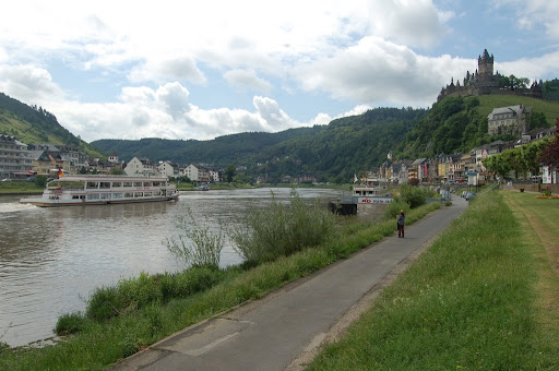
We traveled back to join the Amadagio in Koblenz, at the confluence of the Moselle and Rhine rivers. The name means confluence. The town dates to Roman times and on her walking tour of Koblenz, Margaret saw a roman bridge dating from 49 AD. She saw many historic buildings and and learned some of the history of the town. She shopped for jewelry in the modern part of town, in a Schmuck jewelry shop.
After lunch the crew un-moored the ship and we sailed to the junction of the rivers and turned starboard into the Rhine. It was a beautiful, sunny and warm afternoon to cruise the famous Rhine Gorge, a 65 km stretch of the river between Koblenz and Bingen. The sides of the valley are often steep, reaching sometimes to 200 metres. The natural beauty is part of its charm, but it is most famous for the many castles that are generally perched high on the banks above the river.
One of the most attractive was Marksburg castle, towering on a high crag above Braubach. Is the only fully preserved medieval fortress on the Rhine. It was owned successively by the Eppsteins, the Counts of Katzenelnbogen, and, from 1479, the Landgraves of Hesse, until it fell to the Prussians in 1866, along with Braubach. In 1899 Kaiser Wilhelm II presented the castle to the "Association for the Preservation of German Castles". This association has spared no effort or expense in looking after the building, and has repaired the heavy damage suffered under artillery fire during the last war. The tower, 130 ft. high.
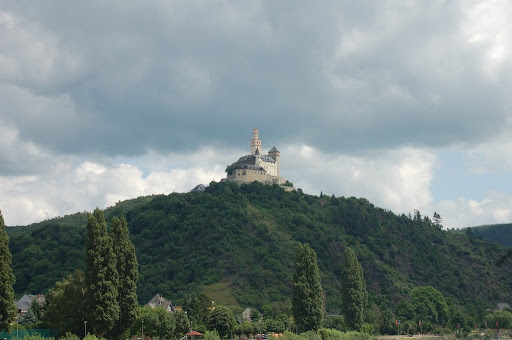
As we cruised the gorge, Lilo, our cruise director, gave a commentary on the castles that we passed. Most of the castles had been destroyed during the Nine Years War, and had been restored during the 19th and 20th Centuries. Watching the beauty around us is was hardly a surprise that the Rhine Gorge had been declared a UNESCO world heritage site.
The Rhine is much wider that the Moselle. The sunny banks were covered with vines and we passed many attractive riverside towns. The valley is a major transport route. The river carries many ships, many of them barges carrying raw materials, and there is a road and railway on either side. Some of the entrances to the railway tunnels looked more like castles than modern constructions. This was done during the second world war, to protect them from allied bombing, as early on there was an agreement not to bomb monuments. That agreement clearly went by the board later in the war. We also passed Loreley Rock which is famous as geographically the narrowest section of the river and in German folklore as the location of a siren who lured sailors to their fates with her hypnotizing voice. Read more here and here . There is a German song about the rhine maiden's beguiling boatmen to their deaths. The words and music can be found here .
At 7:00 pm, during dinner, we arrived at the town of Rudesheim, the most visited of all Rhine villages. It is famous for a little street called the Drosselgasse . This street, less than 100 metres long and less than two metres wide, is jammed with restaurants totalling more than 2,500 seats.
After dinner we boarded a "toy train" similar to the one in Monmatre, and were taken to Siegfried's Musical Kabinett. There we were introduced to a wide range of mechanical musical instruments. One of the first instruments was an original cylindrical gramaphone. The guide played one of the cylinders, and some of you would be interested to know that it was clearly a Salvation Army band and songsters. We are all familiar with pianolas, but many of the music players were much more complex. One included six violins. A circular "bos" moved rotated constantly and the strings were pushed mechanically (outward) to be sounded by the bow! The building that housed the instruments was quite old. There were ceiling murals dating from 1559, which were in the process of rennovation. Naturally we exited through a shop. This is where Margaret bought Amanda's birthday present - a musical box.
We walked back to the boat via the Drosselgasse, and had a Rudesheim Coffee with two New Yorkers, Joe and Sarah. We had an interesting conversation about living in the big apple in a German restaurant. Rudesheim Coffee is a German version of Irish Cofee, replacing whisky with brandy.
The photograph below shows Margaret in the Drosselgasse.


As I said at the outset it was a long day, but very enjoyable.
We split up this morning. Margaret stayed with the ship and cruised to Koblenz while I took the excursion to the Cochem. I disembarked with the others going to Cochem at the village of Winningen. The bus trip took 45 minutes. We had passed the town during the night so we were retracing our night time travel. We passed many small picturesque towns. There were also a surprising numbr of camping / caravan parks along the river.
When we arrived in Cochem, we first went on a tour of the town, which was first mentioned in documents of 866. It received its town charter in 1332. Among the sights that we saw was the a Tower Gate dating from 1332.
We traveled to the castle through narrow, winding, steep streets. The castle was first mentioned in documents in 1051, but most of the current castle does not date from that time as it was destroyed by King Louis XIV's forces in 1689. This was during the War of the Palatinate Succession , sometimes called the Nine Years War. For more details on the history of the castle see this site. Many other castles in the Rhineland were destroyed by the French at this time. Like most of them, Cochem Castle was not rebuilt until the romantic era in the 19th century made old ruins attractive again. In 1868 a Berlin businessman, Mr Louis Ravene bought the castle and rebuilt it in the neo-gothic style. Some of the current building dates to the one that was destroyed. Since 1878 the castle has been owned by the town of Cochem.
The first floor rooms have been furnished so we toured them. They contained some beautiful and expensive pieces of furniture. One of the balconies gave a spectacular view over the town and the river valley. The link to the castle web site above contains a gallery of internal pictures.
The photograph below shows the river, the town and the castle on the hill in the background.
We traveled back to join the Amadagio in Koblenz, at the confluence of the Moselle and Rhine rivers. The name means confluence. The town dates to Roman times and on her walking tour of Koblenz, Margaret saw a roman bridge dating from 49 AD. She saw many historic buildings and and learned some of the history of the town. She shopped for jewelry in the modern part of town, in a Schmuck jewelry shop.
After lunch the crew un-moored the ship and we sailed to the junction of the rivers and turned starboard into the Rhine. It was a beautiful, sunny and warm afternoon to cruise the famous Rhine Gorge, a 65 km stretch of the river between Koblenz and Bingen. The sides of the valley are often steep, reaching sometimes to 200 metres. The natural beauty is part of its charm, but it is most famous for the many castles that are generally perched high on the banks above the river.
One of the most attractive was Marksburg castle, towering on a high crag above Braubach. Is the only fully preserved medieval fortress on the Rhine. It was owned successively by the Eppsteins, the Counts of Katzenelnbogen, and, from 1479, the Landgraves of Hesse, until it fell to the Prussians in 1866, along with Braubach. In 1899 Kaiser Wilhelm II presented the castle to the "Association for the Preservation of German Castles". This association has spared no effort or expense in looking after the building, and has repaired the heavy damage suffered under artillery fire during the last war. The tower, 130 ft. high.
As we cruised the gorge, Lilo, our cruise director, gave a commentary on the castles that we passed. Most of the castles had been destroyed during the Nine Years War, and had been restored during the 19th and 20th Centuries. Watching the beauty around us is was hardly a surprise that the Rhine Gorge had been declared a UNESCO world heritage site.
The Rhine is much wider that the Moselle. The sunny banks were covered with vines and we passed many attractive riverside towns. The valley is a major transport route. The river carries many ships, many of them barges carrying raw materials, and there is a road and railway on either side. Some of the entrances to the railway tunnels looked more like castles than modern constructions. This was done during the second world war, to protect them from allied bombing, as early on there was an agreement not to bomb monuments. That agreement clearly went by the board later in the war. We also passed Loreley Rock which is famous as geographically the narrowest section of the river and in German folklore as the location of a siren who lured sailors to their fates with her hypnotizing voice. Read more here and here . There is a German song about the rhine maiden's beguiling boatmen to their deaths. The words and music can be found here .
At 7:00 pm, during dinner, we arrived at the town of Rudesheim, the most visited of all Rhine villages. It is famous for a little street called the Drosselgasse . This street, less than 100 metres long and less than two metres wide, is jammed with restaurants totalling more than 2,500 seats.
After dinner we boarded a "toy train" similar to the one in Monmatre, and were taken to Siegfried's Musical Kabinett. There we were introduced to a wide range of mechanical musical instruments. One of the first instruments was an original cylindrical gramaphone. The guide played one of the cylinders, and some of you would be interested to know that it was clearly a Salvation Army band and songsters. We are all familiar with pianolas, but many of the music players were much more complex. One included six violins. A circular "bos" moved rotated constantly and the strings were pushed mechanically (outward) to be sounded by the bow! The building that housed the instruments was quite old. There were ceiling murals dating from 1559, which were in the process of rennovation. Naturally we exited through a shop. This is where Margaret bought Amanda's birthday present - a musical box.
We walked back to the boat via the Drosselgasse, and had a Rudesheim Coffee with two New Yorkers, Joe and Sarah. We had an interesting conversation about living in the big apple in a German restaurant. Rudesheim Coffee is a German version of Irish Cofee, replacing whisky with brandy.
The photograph below shows Margaret in the Drosselgasse.

As I said at the outset it was a long day, but very enjoyable.
Monday, June 2, 2008
Europe 08 Bernkastel and Zell
During the night we left Trier and cruised the Moselle River. As our cabin was at the back of the ship we could hear the engines, but as they kept a constant pitch we could "tune them out". We slept well on our first night on the boat.
At 6:00 am I went for a workout in the Gym, which happens to be next to our room. I felt much better after that.
After a typically too large breakfast we watched the crew mooring the ship at Bernkastel. The town is nestled in a bend in a spectacularly beautiful bend in the river.
We met our local guide near the boat. This was very well organised. The ship had a very effective audio system that we used. Passengers took a radio receiver (we had already been given our personal ear buds) and the guide had a microphone and transmitter. We could hear the guide more that 30 metres away. This was convenient as I sometimes moved away from the group to take a photograph. There were four local guides so the groups were fairly small.
Across the river towering above the town on a hill is the "Burgruine Landshut" (ruin of the Castle of Landshut), built in 1277. The guide told us that due to an accidental fire the building burnt down on January 8, 1692.
The guide told us of the history of the town. It became a municipality in 1291. There was probably a Roman settlement there in earlier times. Over the river stands the town of Kues. In 1905 Kues and Bernkastel were joined together as Bernkasgel-Kues. Kues is the birth place of Nicholas of Kues who is often referred to as Nicholas of Cusa (Cusa being the latinised version of Kues). Nicholas was born in 1401 and died in 1464. He was a noted theologian and for some of his time an emissary of the Pope. He also developed some progressive scientific ideas, anticipating Kepler's model of eliptical orbits of the planets. His scientific views were not developed in the usual way of observation of the natural world but from his personal numerological calculations and from his metaphysical musings. Nicholas also made noted contributions to the field of mathematics. Nicholas set up a building (St Nikolaus Hospital) to be used to house old people, which is still being used for that purpose. It contains a famous library with a collection of ancient books and the heart of the philosopher is buried in its chapel. When we returned to the other side of the river we attempted to visit the "hospital" but it was closed.
After we boarded the Amadagio, we cruised on down the Moselle. Lunch was served. A full lunch in the restaurant and a "light" lunch in the lounge. We ate in the lounge - soup, pasta, salads, cold meat and deserts.
Every available metre of the north bank of the river was covered with vines. These were in rows running up and down the hill, to make sure that the plants received as much sun as possible. The main agricultural produce of this area is white wine.
We were reminded of this fact when we arrived at our next town, Zell, late in the afternoon. We were greeted by the Mayor of the town and the Queen of Wine a young woman who spoke excellent English. Some local children performed a dance, dressed as black cats, in reference to a local wine. After another sumptuous dinner we went into town to sample the local product.
There was a brass band concert in the square near the Black Cat fountain and we had tickets for free wine. Margaret particularly liked the very sweet, Black Cat moselle, as you can see from the photo below. The band master had spent some time in New Zealand so he spoke excellent English. The band played a range of songs including favourites from the nationalities represented in his audience. Waltzing Matilda featured as the Australian contribution.

At 6:00 am I went for a workout in the Gym, which happens to be next to our room. I felt much better after that.
After a typically too large breakfast we watched the crew mooring the ship at Bernkastel. The town is nestled in a bend in a spectacularly beautiful bend in the river.
We met our local guide near the boat. This was very well organised. The ship had a very effective audio system that we used. Passengers took a radio receiver (we had already been given our personal ear buds) and the guide had a microphone and transmitter. We could hear the guide more that 30 metres away. This was convenient as I sometimes moved away from the group to take a photograph. There were four local guides so the groups were fairly small.
Across the river towering above the town on a hill is the "Burgruine Landshut" (ruin of the Castle of Landshut), built in 1277. The guide told us that due to an accidental fire the building burnt down on January 8, 1692.
We crossed the bridge and inspected the late 14th century Church of St Michael. Its tower had been incorportate into the city wall and it looked more like a fortification than a church tower. We walked the narrow streets, to the market square, which was surrounded by many well preserved half-timered houses, including the city hall that was built in 1608. Most of the houses dated from the 17th Century. At the centre of the square stood the fountain of St Michael. | 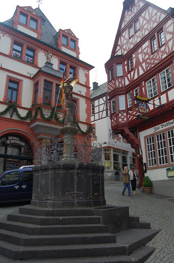 |
The guide told us of the history of the town. It became a municipality in 1291. There was probably a Roman settlement there in earlier times. Over the river stands the town of Kues. In 1905 Kues and Bernkastel were joined together as Bernkasgel-Kues. Kues is the birth place of Nicholas of Kues who is often referred to as Nicholas of Cusa (Cusa being the latinised version of Kues). Nicholas was born in 1401 and died in 1464. He was a noted theologian and for some of his time an emissary of the Pope. He also developed some progressive scientific ideas, anticipating Kepler's model of eliptical orbits of the planets. His scientific views were not developed in the usual way of observation of the natural world but from his personal numerological calculations and from his metaphysical musings. Nicholas also made noted contributions to the field of mathematics. Nicholas set up a building (St Nikolaus Hospital) to be used to house old people, which is still being used for that purpose. It contains a famous library with a collection of ancient books and the heart of the philosopher is buried in its chapel. When we returned to the other side of the river we attempted to visit the "hospital" but it was closed.
After we boarded the Amadagio, we cruised on down the Moselle. Lunch was served. A full lunch in the restaurant and a "light" lunch in the lounge. We ate in the lounge - soup, pasta, salads, cold meat and deserts.
Every available metre of the north bank of the river was covered with vines. These were in rows running up and down the hill, to make sure that the plants received as much sun as possible. The main agricultural produce of this area is white wine.
We were reminded of this fact when we arrived at our next town, Zell, late in the afternoon. We were greeted by the Mayor of the town and the Queen of Wine a young woman who spoke excellent English. Some local children performed a dance, dressed as black cats, in reference to a local wine. After another sumptuous dinner we went into town to sample the local product.
There was a brass band concert in the square near the Black Cat fountain and we had tickets for free wine. Margaret particularly liked the very sweet, Black Cat moselle, as you can see from the photo below. The band master had spent some time in New Zealand so he spoke excellent English. The band played a range of songs including favourites from the nationalities represented in his audience. Waltzing Matilda featured as the Australian contribution.

Sunday, June 1, 2008
Europe 08 Paris to Trier
An early start this morning. Our cases had to be out in the corridor by 6:30 am. Then our last breakfast in Paris. After breakfast I identified our luggage to Lilo, the cruise director. This is a process that ensures only tour member's luggage is taken on to the bus.
At about 8:10 our bus left the hotel for a five hour drive to Luxembourg.
It was a pleasant enough drive, but convinced up that we would not want to travel like that for the whole holiday.
We had a quick lunch in the a take away shop in the central square and then went on a walking tour with a local guide. During the tour we saw some of the sights of the town and were told of the history of the Grand Dutchy, which dates back to 963. Over many centuries Luxembourg has been buffeted by the large countries that surround it - France, Germany and Belgium.
For details of the history of Luxembourg see this link.
Luxembourg is a parliamentary democracy headed by a constitutional monarch, the Grand Duke. On our walk around the town we saw the building were the Grand Duke conducts his business. There was one soldier marching up and down outside it, and we made jokes about the location of the other two members of the Luxembourg army. (While researching when we arrived home I discovered that the Luxembourg army has about 800 members.
The guide told us that there are three official languages in Luxembourg - Luxembourgish, French and German. Luxembourgish is similar to the German dialect spoken in neighbouring parts of Germany.
We also saw parts of the old city walls.
Even though it is tiny, about 2,586 square kilometres, Luxembourg has an important role in Europe. It was one of the six founding members of the European Economic Community which became the European Union. It hosts some of the functions of the EU and the majority of the population are not native born Luxenbourgers.
After the tour we drive on to Trier, which is the oldest German history, boasting Roman ruins over 2000 years old. There are two sets of Roman baths, and Imperial Residence, Ampitheatre and part of the Roman wall, called the Black Gate.
We briefly drove around the town and passed a house where Karl Marx had once lived. Unfortunately we only had a brief bus tour of the town. At the time we were not particularly concerned about that because we were interested in getting to the ship.
Our ship, the Amadagio was docked at the port of Trier, which like many other docks was quite ugly. On embarkation we were given the keys to our room and settled in. After a while the crew brought our cases and we put our clothes away in the wardrobe and draws and pushed the cases under the bed not to be disturbed for three weeks.
The cabin was quite not as big as a hotel room, but was still quite comfortable. There was a double bed, desk with computer (which had free access to the Internet, music and films), a toilet, washbasin and shower room. It also had a large window which could be opened wide.
We all gathered in the lounge at the front of the boat to be introduced to the crew. The most memorable part of this was the entertaining safety talk given by the Captain. Although he was hilarious, the Captain conveyed the important safety information. The crew is from four main nations - German, Russian/Ucranian, German, Romanian and Bulgarian. All speak excellent English.
After the introduction of the crew, we adjourned to the restaurant. The meal was excellent. I had a very tender medium steak.
After dinner we were entertained by La Strada a group that consistd of two violinists and a guitarist. They played a range of popular light classics by Verdi, Chopin, Revel and some gypsy music.
We happily returned to our cabin and during the night the ship unmoored and headed to our next destination.
The diagrams below show the deck plans of the ship. Our cabin was 331, next to the Gym and aft lounge.

At about 8:10 our bus left the hotel for a five hour drive to Luxembourg.
It was a pleasant enough drive, but convinced up that we would not want to travel like that for the whole holiday.
We had a quick lunch in the a take away shop in the central square and then went on a walking tour with a local guide. During the tour we saw some of the sights of the town and were told of the history of the Grand Dutchy, which dates back to 963. Over many centuries Luxembourg has been buffeted by the large countries that surround it - France, Germany and Belgium.
For details of the history of Luxembourg see this link.
Luxembourg is a parliamentary democracy headed by a constitutional monarch, the Grand Duke. On our walk around the town we saw the building were the Grand Duke conducts his business. There was one soldier marching up and down outside it, and we made jokes about the location of the other two members of the Luxembourg army. (While researching when we arrived home I discovered that the Luxembourg army has about 800 members.
The guide told us that there are three official languages in Luxembourg - Luxembourgish, French and German. Luxembourgish is similar to the German dialect spoken in neighbouring parts of Germany.
We also saw parts of the old city walls.
Even though it is tiny, about 2,586 square kilometres, Luxembourg has an important role in Europe. It was one of the six founding members of the European Economic Community which became the European Union. It hosts some of the functions of the EU and the majority of the population are not native born Luxenbourgers.
After the tour we drive on to Trier, which is the oldest German history, boasting Roman ruins over 2000 years old. There are two sets of Roman baths, and Imperial Residence, Ampitheatre and part of the Roman wall, called the Black Gate.
We briefly drove around the town and passed a house where Karl Marx had once lived. Unfortunately we only had a brief bus tour of the town. At the time we were not particularly concerned about that because we were interested in getting to the ship.
Our ship, the Amadagio was docked at the port of Trier, which like many other docks was quite ugly. On embarkation we were given the keys to our room and settled in. After a while the crew brought our cases and we put our clothes away in the wardrobe and draws and pushed the cases under the bed not to be disturbed for three weeks.
The cabin was quite not as big as a hotel room, but was still quite comfortable. There was a double bed, desk with computer (which had free access to the Internet, music and films), a toilet, washbasin and shower room. It also had a large window which could be opened wide.
We all gathered in the lounge at the front of the boat to be introduced to the crew. The most memorable part of this was the entertaining safety talk given by the Captain. Although he was hilarious, the Captain conveyed the important safety information. The crew is from four main nations - German, Russian/Ucranian, German, Romanian and Bulgarian. All speak excellent English.
After the introduction of the crew, we adjourned to the restaurant. The meal was excellent. I had a very tender medium steak.
After dinner we were entertained by La Strada a group that consistd of two violinists and a guitarist. They played a range of popular light classics by Verdi, Chopin, Revel and some gypsy music.
We happily returned to our cabin and during the night the ship unmoored and headed to our next destination.
The diagrams below show the deck plans of the ship. Our cabin was 331, next to the Gym and aft lounge.

Saturday, May 31, 2008
Europe 08 Paris Day 3
On Thursday i had watched Phil and Bev navigate around Paris using the Metro (underground railway). Today we decided to attempt the feat ourselves and visit a number of landmarks via the metro.
You can follow the route on the partial map of the metro below:
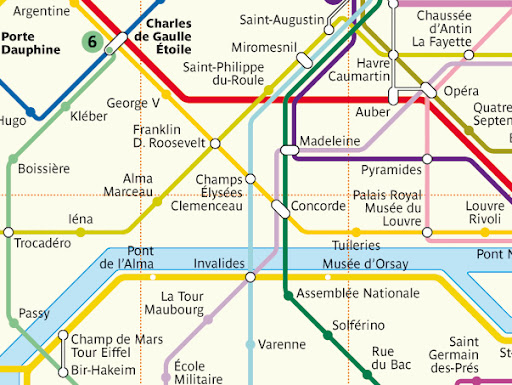
There was a metro station near our hotel - Champs de Mars Tour Eiffel, on the C line. It is located in the bottom left of the map. We made our way there and fairly quickly worked out how to buy tickets from the vending machine. Our first destination was Place de la Concorde. We looked at the signs to determine which platform to use. Within five minutes a train arrived and we traveled two stations to Invalides. There we swapped to line 8, coloured mauve and went one station to Concorde. When we walked up the exit stairs I expected to be in Place de la Concorde and it was gratifying to discover that my navigation had worked and the grand panorama of the square opened up.
The Wikipedia article linked to above states the following about the square:
The Directory, the government that followed Robespierre's, changed the name to the current one as a gesture of reconciliation.
The centre of the square is occupied by a giant Egyptian obelisk decorated with hieroglyphics exalting the reign of the pharaoh Ramses II. The obelisk once marked the entrance to the Luxor Temple. The viceroy of Egypt, Mehemet Ali, offered the 3,300-year-old Luxor Obelisk to France in 1831. The obelisk arrived in Paris on December 21, 1833. The red granite column is 23 metres (75 ft) high, including the base, and weighs over 250 metric tonnes. The original cap is missing, believed stolen in the 6th century BC. the government of France added a gold-leafed pyramid cap to the top of the obelisk in 1998.
It was interesting to walk around this square, taking photographs and thinking about its history.
We walked to the nearby Le Madeleine past many up market jewelery shops including Cartier then returned to the metro. We found line 1 which in this section follows the Champs Elysees and exited at Charles de Gaule Etoile station. As expected as we exited the station the Arc de Triumph towered before us in the middle of its large roundabout. I wanted to return to the Arch to climb to the top. Margaret was happy to sit and watch the frenetic Parisian traffic negotiate the roundabout - there are about a dozen roads entering and leaving it causing the most chaotic traffic we were to see until Istanbul.
The last location I wished to visit that day was Musee D'Orsay the gallery of modern art. We returned to Concorde station the way we had come; changed lines to line 8 and traveled to Invalides; changed again to the C line and exited the system at Musee D'Orsay station.
Before we entered the gallery we ate some lunch - that consisted of rolls and fruit that Margaret had "stolen" at breakfast time. In the gallery I saw many familiar works by: Manet, Monet, Pissaro, Cezanne, van Gogh, Renoir, Gauguin and Rodin's sculpture of Balzac.
We then returned to the hotel by way of the C line.
This trip was still something of a reconnaissance for our next trip to Paris. On that visit I want to spend a day at the Louvre, another at Versailles and also travel into the country side to Villers-Bretonneux. The first two are obvious enough as we did not have enough time at the Louvre and have not seen Versailles at all. The reason for Villers-Bretonneux is given in this post.
On the way back to the hotel I noticed that Versailles could be reached via the C line, but that only some trains went there, as the line divides soon after Champs de Mars Tour Eiffel. This is the sort of information that will allow us to plan our own visit to Paris in the future.
It was a great way to finish off our visit to Paris.
You can follow the route on the partial map of the metro below:
There was a metro station near our hotel - Champs de Mars Tour Eiffel, on the C line. It is located in the bottom left of the map. We made our way there and fairly quickly worked out how to buy tickets from the vending machine. Our first destination was Place de la Concorde. We looked at the signs to determine which platform to use. Within five minutes a train arrived and we traveled two stations to Invalides. There we swapped to line 8, coloured mauve and went one station to Concorde. When we walked up the exit stairs I expected to be in Place de la Concorde and it was gratifying to discover that my navigation had worked and the grand panorama of the square opened up.
The Wikipedia article linked to above states the following about the square:
The Place was designed by Ange-Jacques Gabriel in 1755 as a moat-skirted octagon between the Champs-Élysées to the west and the Tuileries Gardens to the east. Filled with statues and fountains, the area was named Place Louis XV to honor the then king.
During the French Revolution the statue of King Louis was torn down and the area renamed "Place de la Révolution". In a grim reminder to the nobility of a gruesome past, when the "Place de Grève" was a site where the nobility and members of the bourgeoisie were entertained watching convicted criminals being dismembered alive, the new revolutionary government erected the guillotine there. The first notable to be executed at the Place de la Révolution was King Louis XVI, on January 21, 1793. Other important people guillotined there, often in front of cheering crowds, were Queen Marie Antoinette, Madame Élisabeth, Charlotte Corday, Madame du Barry, Danton, Desmoulins, Lavoisier, Robespierre and Louis de Saint-Just.
The Directory, the government that followed Robespierre's, changed the name to the current one as a gesture of reconciliation.
The centre of the square is occupied by a giant Egyptian obelisk decorated with hieroglyphics exalting the reign of the pharaoh Ramses II. The obelisk once marked the entrance to the Luxor Temple. The viceroy of Egypt, Mehemet Ali, offered the 3,300-year-old Luxor Obelisk to France in 1831. The obelisk arrived in Paris on December 21, 1833. The red granite column is 23 metres (75 ft) high, including the base, and weighs over 250 metric tonnes. The original cap is missing, believed stolen in the 6th century BC. the government of France added a gold-leafed pyramid cap to the top of the obelisk in 1998.
It was interesting to walk around this square, taking photographs and thinking about its history.
We walked to the nearby Le Madeleine past many up market jewelery shops including Cartier then returned to the metro. We found line 1 which in this section follows the Champs Elysees and exited at Charles de Gaule Etoile station. As expected as we exited the station the Arc de Triumph towered before us in the middle of its large roundabout. I wanted to return to the Arch to climb to the top. Margaret was happy to sit and watch the frenetic Parisian traffic negotiate the roundabout - there are about a dozen roads entering and leaving it causing the most chaotic traffic we were to see until Istanbul.
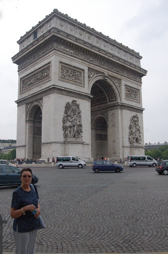 | I did not want to negotiate the traffic as some crazy teenagers were doing, so I went looking for the underpass. It was fairly difficult to find, but eventually I found myself under the arch. It was necessary to buy tickets to climb to the top and there was a fairly long line so after looking around for a while I returned to find Margaret. When I reached the location where I thought I had left her she was not there! I realised that I should have taken a bearing on the Arch when I left her as most of the intersections looked alike. Eventually I found her after crossing a few more streets. |
The last location I wished to visit that day was Musee D'Orsay the gallery of modern art. We returned to Concorde station the way we had come; changed lines to line 8 and traveled to Invalides; changed again to the C line and exited the system at Musee D'Orsay station.
Before we entered the gallery we ate some lunch - that consisted of rolls and fruit that Margaret had "stolen" at breakfast time. In the gallery I saw many familiar works by: Manet, Monet, Pissaro, Cezanne, van Gogh, Renoir, Gauguin and Rodin's sculpture of Balzac.
We then returned to the hotel by way of the C line.
This trip was still something of a reconnaissance for our next trip to Paris. On that visit I want to spend a day at the Louvre, another at Versailles and also travel into the country side to Villers-Bretonneux. The first two are obvious enough as we did not have enough time at the Louvre and have not seen Versailles at all. The reason for Villers-Bretonneux is given in this post.
On the way back to the hotel I noticed that Versailles could be reached via the C line, but that only some trains went there, as the line divides soon after Champs de Mars Tour Eiffel. This is the sort of information that will allow us to plan our own visit to Paris in the future.
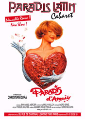 | That evening we attended another additional excursion to the Paradis Latin Cabaret which is in the Latin Quarter of Paris. I had thought that the Latin Quarter referred to the ethnic mix of the are - i.e. Latins, or southerners lived there, giving it a bohemian character. The tour guide explained that it refers to the language Latin. It is the education quarter - the Sorbonne and other schools are there. The scholarly quarter. Of cause we didn't expect that Paradis Latin would be an intellectual experience, but it was a lot of fun, with song, dance and a great aerial, trapeze act involving precision and stupendous strength. It was hardly a surprise that the show was much better than the food. |
It was a great way to finish off our visit to Paris.
Friday, May 30, 2008
Europe 08 Paris Day 2
The cost of the the tour of Europe includes many city tours.
This morning we took the included Paris city tour. As in all of the city tours a group of local guides were provided. We traveled around Paris with the blue bus group and guide. We saw many of the major sights of Paris and our guide filled us in on the history of Paris and of the major landmarks. As the Tour Eiffel was near our hotel we drove past it first. We drove the full length of the Champs Elysees (from Place de la Concorde to Arc de Triumph), and also saw: Hotel des Invilides, Madelaine, L'Opera, Louvre, Musee D'Orsee, and Notre Dame. We alighted the bus at Notre Dame and went of a walking tour around the Cathedral and then went inside. We came across more gypsy scammers, and this is where I finally tired of them and swore at one of them.
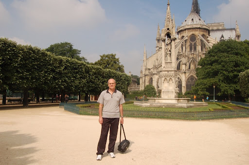
The facade of Notre Dame is world famous, but I find the view from the back even more interesting. I remember in school art classes studying Gothic architecture. The architects attempted to build high walls with plenty of glass, but such constructions (before the age of steel) required buttressing from outside. Notre Dame has buttresses that support the wall half way up and others that "fly" near to the top. They are called flying buttresses, and to my eye look surprisingly modern. They can be seen in the photo below. The last time that we were in Paris the read portion of the cathedral was covered in scaffolding, so I was pleased to get an unobstructed view this time.
After about an hour we returned to the bus and continued the tour. Margaret and I left the bus at Place de la Trocedoro. We had a pleasant lunch at a restaurant called La Malakoff watching people walking around the square and the traffic negotiating the roundabout.
The square makes an excellent vantage point to view the Eiffel Tower. We walked home via the Tower. In the afternoon we had a rest in preparation for our evening tour to Monmatre. It is possible that we needed a rest as jet lag was at last kicking in.
The Monmatre tour was one of the additional ones that cost extra, but it was well worth the money.
We were bussed to Monmatre, on its hill in Northern Paris. On the way we passed the famous Moulin Rouge. Busses can't drive up the narrow Monmatre streets so we took a "train" somewhat reminiscent of the "trains" that take kids for rides in shopping centres.
Montmartre has been known for its many artists since 1880. Until 1873, when the Sacré-Coeur was built on top of the hill, Montmartre was a small village, inhabited by a mostly farming community. It still retains a village like atmosphere, with many restaurants, shops and artists ready to draw eager tourists - for a price.
We followed the guide as she took us on a walking tour of the narrow cobbled streets. The highlight, of cause, was the basilica. I had seen many photos and drawings of it but was not prepared for its grandeur, "in real life". The cupola is 83 metres high, and its position on the Monmatre hill makes it even more spectacular. It is a mix of styles generally described as Roman - Byzantine.
The reasons for the building of Sacre Coeur are somewhat controversial. Although the idea had been around for some time in ultra-Catholic and royalist circles it gained considerable ground after the disaster of the Franco-Prussian war and the Paris Commune. An article in Wikipedia notes:
The Monmatre hill was a difficult location to build such a large construction and it was not completed until 1914, and not consecrated until 1919 after the war. By then a much larger disaster had occurred so the original reasons for building it were not particularly important.
After dinner in a creperie we returned to the front of the basilica. There were many people sitting on the steps, listening to a guitarist, as can be seen in the photograph below. Margaret stayed there while I reentered the basilica.

I returned to Sacre Coeur because of the awesome beauty of the interior. In yesterday's post I made comment in relation to the Louvre that architecture should be judged by its utility and beauty both inside and outside. Although I was aware of the beauty of Sacre Coeur exterior I was unprepared for its overwhelming interior. It is a very large open space with a huge mural on the cupola. The taking of photographs inside was not allowed. I found the photo below after an extensive Internet search. It gives some sense of the interior but falls far short of its breathtaking size and awe inspiring atmosphere.

One of the issues that would recur during the following month was the "meeting point" and time for leaving. The second reason that we returned to the basilica was that it was near the meeting point. We didn't want to be late.
We returned to the lower areas of Monmatre via a funicular railway, and walked back to the bus past many brightly lit shop windows.
We returned to the Hotel by a circuitous route taking many of the major sights under floodlight.
This morning we took the included Paris city tour. As in all of the city tours a group of local guides were provided. We traveled around Paris with the blue bus group and guide. We saw many of the major sights of Paris and our guide filled us in on the history of Paris and of the major landmarks. As the Tour Eiffel was near our hotel we drove past it first. We drove the full length of the Champs Elysees (from Place de la Concorde to Arc de Triumph), and also saw: Hotel des Invilides, Madelaine, L'Opera, Louvre, Musee D'Orsee, and Notre Dame. We alighted the bus at Notre Dame and went of a walking tour around the Cathedral and then went inside. We came across more gypsy scammers, and this is where I finally tired of them and swore at one of them.
The facade of Notre Dame is world famous, but I find the view from the back even more interesting. I remember in school art classes studying Gothic architecture. The architects attempted to build high walls with plenty of glass, but such constructions (before the age of steel) required buttressing from outside. Notre Dame has buttresses that support the wall half way up and others that "fly" near to the top. They are called flying buttresses, and to my eye look surprisingly modern. They can be seen in the photo below. The last time that we were in Paris the read portion of the cathedral was covered in scaffolding, so I was pleased to get an unobstructed view this time.
After about an hour we returned to the bus and continued the tour. Margaret and I left the bus at Place de la Trocedoro. We had a pleasant lunch at a restaurant called La Malakoff watching people walking around the square and the traffic negotiating the roundabout.
The square makes an excellent vantage point to view the Eiffel Tower. We walked home via the Tower. In the afternoon we had a rest in preparation for our evening tour to Monmatre. It is possible that we needed a rest as jet lag was at last kicking in.
The Monmatre tour was one of the additional ones that cost extra, but it was well worth the money.
We were bussed to Monmatre, on its hill in Northern Paris. On the way we passed the famous Moulin Rouge. Busses can't drive up the narrow Monmatre streets so we took a "train" somewhat reminiscent of the "trains" that take kids for rides in shopping centres.
Montmartre has been known for its many artists since 1880. Until 1873, when the Sacré-Coeur was built on top of the hill, Montmartre was a small village, inhabited by a mostly farming community. It still retains a village like atmosphere, with many restaurants, shops and artists ready to draw eager tourists - for a price.
We followed the guide as she took us on a walking tour of the narrow cobbled streets. The highlight, of cause, was the basilica. I had seen many photos and drawings of it but was not prepared for its grandeur, "in real life". The cupola is 83 metres high, and its position on the Monmatre hill makes it even more spectacular. It is a mix of styles generally described as Roman - Byzantine.
The reasons for the building of Sacre Coeur are somewhat controversial. Although the idea had been around for some time in ultra-Catholic and royalist circles it gained considerable ground after the disaster of the Franco-Prussian war and the Paris Commune. An article in Wikipedia notes:
Though today it is asserted to be dedicated in honor of the 58,000 who lost their lives during the war, the decree of the Assemblée nationale, 24 July 1873, responding to a request by the archbishop of Paris by voting its construction, specifies that it is to "expiate the crimes of the communards"[2]. Montmartre had been the site of the Commune's first insurrection, and many hard-core communards were forever entombed in the subterranean galleries of former gypsum mines where they had retreated, by explosives detonated at the entrances by the Army of Versailles. Hostages had been executed on both sides, and the Communards had executed Georges Darboy, Archbishop of Paris, who became a martyr for the resurgent Catholic Church. His successor Guibert, climbing the Butte Montmartre in October 1872, was reported to have had a vision, as clouds dispersed over the panorama: "It is here, it is here where the martyrs are,[3] it is here that the Sacred Heart must reign so that it can beckon all to come".[4]
The Monmatre hill was a difficult location to build such a large construction and it was not completed until 1914, and not consecrated until 1919 after the war. By then a much larger disaster had occurred so the original reasons for building it were not particularly important.
After dinner in a creperie we returned to the front of the basilica. There were many people sitting on the steps, listening to a guitarist, as can be seen in the photograph below. Margaret stayed there while I reentered the basilica.

I returned to Sacre Coeur because of the awesome beauty of the interior. In yesterday's post I made comment in relation to the Louvre that architecture should be judged by its utility and beauty both inside and outside. Although I was aware of the beauty of Sacre Coeur exterior I was unprepared for its overwhelming interior. It is a very large open space with a huge mural on the cupola. The taking of photographs inside was not allowed. I found the photo below after an extensive Internet search. It gives some sense of the interior but falls far short of its breathtaking size and awe inspiring atmosphere.

One of the issues that would recur during the following month was the "meeting point" and time for leaving. The second reason that we returned to the basilica was that it was near the meeting point. We didn't want to be late.
We returned to the lower areas of Monmatre via a funicular railway, and walked back to the bus past many brightly lit shop windows.
We returned to the Hotel by a circuitous route taking many of the major sights under floodlight.
Thursday, May 29, 2008
Europe 08 Paris Day 1
We had stayed up as late as possible our first night in Paris, so we were extremely tired when we went to bed and slept fairly well.
The next morning we felt reasonably rested and not particularly jet lagged.
I went down to the foyer to have a look around before we left for the Tower. In the foyer I found the table with our Tour Director waiting to meet her travelers. Her name was Lilo. I introduced myself and Lilo explained that the 150 passengers were to be divided up into four groups; blue red green and yellow for purposes of touring Paris and for the Sunday trip to the boat. I opted for blue group, and noticed that we were the second couple to meet Lilo. She gave me the itinerary for Paris. There was a tour that was included in the price of the trip and some extras that required more payment.
We met Phil, Bev and the kids at the Eiffel Tower morning. As we stood in line we were asked innumerable times to buy miniature Eiffel Towers. Marg bought a few for the children. The sellers were mainly from North Africa, probably Algerians. There were so many of them that it was difficult to see how they could earn any money. I had a chance to test my relaxed frame of mind resolution. We arrived at the Tower earlier than Phil, so we stood in line and bought tickets for us all. I was concerned that Phil would not be able to find us when we had bought the tickets as there are four entrances. Naturally he arrived in the nick of time and found us.
We traveled to the top floor. This is done via two lifts. The first lift takes passengers to the first or second floors. On the second floor, which is fairly high up already, we changed to the lift for the top floor. Even though we were at the Tower early, there was still a necessity to stand in lines. Later in the day the lines become enormous.
The views from the top were spectacular. Clearly visible were: our hotel, Arc de Triumph, Notre Dame, Hotel des Invilides, Monmatre and Sacre Coeur on a hill to the north, Ecole Militaire, Champs de Mars and the skyscrapers of the financial district.
As the lifts were busy we all walked down from the second floor at least some of the way. Some of us paid with sore legs next day.
We had lunch at the Carousel between the tower and the river. There we came across our first gypsy scam artists. Some gypsy women asked if we could speak English. Margaret said that she could and the girl gave her a note with a spectacular sob story and asked for money. We were regularly pestered by girls using the same scam all day. Later I got so exasperated that I swore at one of them.
On the way to the Metro we came across another scam attempt. A man walked past us and dropped a ring behind Philip. He turned around and offered the ring to Phil and started to walk away. Then he came back and asked for money. Phil got into a fairly heated argument, and eventually gave the ring back and told the scammer to nick off.
We went to the Louver via Metro. I watched how Phil and Bev navigated around and stored away the information for later on.
We left a metro station and walked past a few shops and restaurants to the entrance to the Louver. We walked along a wide passage with shops and eateries, and miraculously came out under "the pyramid". I had previously only seen the pyramid from outside. I thought its modernism clashed with the classical architecture of the Louvre itself. This was, though, a completely different view. It worked wonderfully well from inside (or underneath) as a huge skylight. Conclusion: don't judge architecture until you have seen it from inside as well as outside.
The artwork in the Louvre is not only hanging on the walls and free standing as sculpture. The building itself was an artwork, particularly the murals on the ceilings. We did not spend much time in the Louvre ...
The next time we go to Paris I plan to spend a day at the Louvre, after carrying out some comprehensive research beforehand.
We returned to Philip and Bev's room in the Marriot hotel on the Champs Elysees. Very swish! We relaxed in the room for a while then Philip and I went for a walk along the Champs Elysees. Although the street is the height of chic and style with many very famous brands represented there we found a department store come super market (called Monoprix) close to the hotel. We bought a few provisions there.
We went for dinner to a nearby restaurant. There were eight of us. Like many Parisian restaurants it was arranged for couples with tables for two sprinkled about the room. I decided to test my schoolboy French and said to the waiter "table pour huit". I realised that I had successfully conveyed my message as the waiter went off and put four of the tables together. We ate a convivial meal of pasta or pizza.
Later that evening we walked back to the Eiffel Tower to see the evening light show. The tower is floodlit at night and for the first three or four hours after dark a glittering light show occurs for ten minutes. After the show we said goodbye to Phil, Bev and the kids and returned to our hotel room.
The next morning we felt reasonably rested and not particularly jet lagged.
I went down to the foyer to have a look around before we left for the Tower. In the foyer I found the table with our Tour Director waiting to meet her travelers. Her name was Lilo. I introduced myself and Lilo explained that the 150 passengers were to be divided up into four groups; blue red green and yellow for purposes of touring Paris and for the Sunday trip to the boat. I opted for blue group, and noticed that we were the second couple to meet Lilo. She gave me the itinerary for Paris. There was a tour that was included in the price of the trip and some extras that required more payment.
We met Phil, Bev and the kids at the Eiffel Tower morning. As we stood in line we were asked innumerable times to buy miniature Eiffel Towers. Marg bought a few for the children. The sellers were mainly from North Africa, probably Algerians. There were so many of them that it was difficult to see how they could earn any money. I had a chance to test my relaxed frame of mind resolution. We arrived at the Tower earlier than Phil, so we stood in line and bought tickets for us all. I was concerned that Phil would not be able to find us when we had bought the tickets as there are four entrances. Naturally he arrived in the nick of time and found us.
We traveled to the top floor. This is done via two lifts. The first lift takes passengers to the first or second floors. On the second floor, which is fairly high up already, we changed to the lift for the top floor. Even though we were at the Tower early, there was still a necessity to stand in lines. Later in the day the lines become enormous.
The views from the top were spectacular. Clearly visible were: our hotel, Arc de Triumph, Notre Dame, Hotel des Invilides, Monmatre and Sacre Coeur on a hill to the north, Ecole Militaire, Champs de Mars and the skyscrapers of the financial district.
 | Margaret and Hayley on the second floor |
| Margaret, Beverley, Philip, Hayley, Jack (Bev's youngest) and Jeremy |  |
 | Paris from the tower, Monmatre in the background (with the glorious Sacre Coeur) |
| Margaret and Beverley chat near the tower |  |
As the lifts were busy we all walked down from the second floor at least some of the way. Some of us paid with sore legs next day.
We had lunch at the Carousel between the tower and the river. There we came across our first gypsy scam artists. Some gypsy women asked if we could speak English. Margaret said that she could and the girl gave her a note with a spectacular sob story and asked for money. We were regularly pestered by girls using the same scam all day. Later I got so exasperated that I swore at one of them.
On the way to the Metro we came across another scam attempt. A man walked past us and dropped a ring behind Philip. He turned around and offered the ring to Phil and started to walk away. Then he came back and asked for money. Phil got into a fairly heated argument, and eventually gave the ring back and told the scammer to nick off.
We went to the Louver via Metro. I watched how Phil and Bev navigated around and stored away the information for later on.
We left a metro station and walked past a few shops and restaurants to the entrance to the Louver. We walked along a wide passage with shops and eateries, and miraculously came out under "the pyramid". I had previously only seen the pyramid from outside. I thought its modernism clashed with the classical architecture of the Louvre itself. This was, though, a completely different view. It worked wonderfully well from inside (or underneath) as a huge skylight. Conclusion: don't judge architecture until you have seen it from inside as well as outside.
The artwork in the Louvre is not only hanging on the walls and free standing as sculpture. The building itself was an artwork, particularly the murals on the ceilings. We did not spend much time in the Louvre ...
| ... but on the way to finding the Mona Lisa we came across Bernardino Luini's Salome Receiving the Head of John the Baptist. Philip read the details while Jeremy looked at the picture ... amazed. | 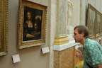 |
The next time we go to Paris I plan to spend a day at the Louvre, after carrying out some comprehensive research beforehand.
We returned to Philip and Bev's room in the Marriot hotel on the Champs Elysees. Very swish! We relaxed in the room for a while then Philip and I went for a walk along the Champs Elysees. Although the street is the height of chic and style with many very famous brands represented there we found a department store come super market (called Monoprix) close to the hotel. We bought a few provisions there.
We went for dinner to a nearby restaurant. There were eight of us. Like many Parisian restaurants it was arranged for couples with tables for two sprinkled about the room. I decided to test my schoolboy French and said to the waiter "table pour huit". I realised that I had successfully conveyed my message as the waiter went off and put four of the tables together. We ate a convivial meal of pasta or pizza.
Later that evening we walked back to the Eiffel Tower to see the evening light show. The tower is floodlit at night and for the first three or four hours after dark a glittering light show occurs for ten minutes. After the show we said goodbye to Phil, Bev and the kids and returned to our hotel room.
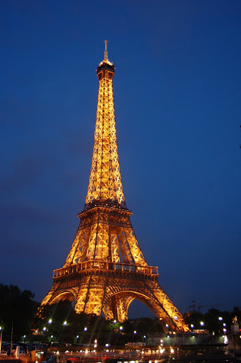 | The tower floodlit at night |
Wednesday, May 28, 2008
Europe08 Flying to Europe
We now live much further from the Airport. Michelle took us to the airport. We eventually took off at 10:10 pm about half an hour late. My watch has duel times so I set the second time to France's time. (Actually I set it to England's time not realising that even though Paris and London have virtually the same longitude France uses European Central Time rather than GMT so there is an hour difference.)
Philip (Calder) had advised me to move my activities to the time of my destination as soon as I entered the plane, to minimise jetlag at the other end. Given that I find it difficult to sleep on a plane for more than a few minutes at a time, it changing to Paris time probably didn't make much difference.
I read Misha Glenny's masterful book The Balkans and when I became too tired to read (but not enough to sleep properly) I switched to playing solitaire on the personal monitor. (For those who haven't been on an international flight recently, each passenger has a video monitor with a wide range of entertainment features.) I also kept a check on our progress using the Airshow feature of the monitor. Margaret watched three movies: The Bucket List, Bonnie and Clyde and The Bourne Identity.
We arrived in Dubai at 5:30 am local time, after a 13 hour trip. The plane has two cameras that can be accessed by passengers - one pointing to the front one looking down. I watched the landing from the front pointing camera. The lights of the ariport could be seen from a long way out. Dubai airport is being upgraded so our plane didn't stop at an air bridge, instead it parked way out in the boondocks and we took a shuttle bus to the terminal. Although it was very early in the morning it was already very hot.
Airline food literally "gives me the shits" so I had to find a toilet quickly. I apparently wasn't the only one in a hurry and I had to wait in line, getting some sense of a regular problem for women. When I got to the cubicle it was a squat down one!
Dubai airport - home of Emirates - is very large. Our flight was from gate 38 which we found quite easily. The 2.5 hour wait passed fairly quickly.
One trap in flying is excessive meals. This morning we were offered two breakfasts. The first on the flight from Melbourne to Dubai before landing at Dubai; the second soon after we took off from Dubai (on the way to Paris). I declined the second one. I thought of Hobbits who have who routinely have two breakfasts.
The flight to Paris took 6 hours. When we arrived at Paris we had to find passport control and luggage pickup (an easy task just follow the other passengers). After that we had to find where to meet our Airport / Hotel Transit driver and find that location. During our last international trip, I damaged the experience for both of us by panicking and stressing too much. Before we left I made a resolution to be relaxed and take it "one issue at a time", as I was sure that we could resolve any problem that arose. Here was my chance to put that resolution into practice. After we retreived our luggage we found a phone and rang the Transit company. We were told to wait outside exit number 8. We found the exit easily where we come across some people who were doing a mild stress about their transit. I decided that if the transit did not arrive we could easily catch a taxi, so there was no need to worry. After about 20 minutes our transit arrived. We were taken to our hotel by a round about route, taking other transit customers to their hotels.
We arrived a day early, as the air fare was cheaper, so I had booked a room at the hotel on the Internet last year. At home I had been stressing about the booking - "what if we arrived at the hotel and the booking had not worked?" When we arrived at the hotel, in my new relaxed frame of mind I was confident that the hotel book in would work well, and of cause it did.
The Hilton in Paris is quite an old hotel. It was state of the art when it was built, 40 years ago, and was still acceptable, though not as flash as some others we have stayed in.
Philip, Bev and the kids came around at 7:00 pm and we went to a local restaurant for dinner. We found a waiter in the restaurant who could speak English so the ordering went without a problem. We then walked around to the Eiffel Tower, less than a block away, and made plans to meet there the next morning. We then returned to our respective hotel rooms.
Philip (Calder) had advised me to move my activities to the time of my destination as soon as I entered the plane, to minimise jetlag at the other end. Given that I find it difficult to sleep on a plane for more than a few minutes at a time, it changing to Paris time probably didn't make much difference.
I read Misha Glenny's masterful book The Balkans and when I became too tired to read (but not enough to sleep properly) I switched to playing solitaire on the personal monitor. (For those who haven't been on an international flight recently, each passenger has a video monitor with a wide range of entertainment features.) I also kept a check on our progress using the Airshow feature of the monitor. Margaret watched three movies: The Bucket List, Bonnie and Clyde and The Bourne Identity.
We arrived in Dubai at 5:30 am local time, after a 13 hour trip. The plane has two cameras that can be accessed by passengers - one pointing to the front one looking down. I watched the landing from the front pointing camera. The lights of the ariport could be seen from a long way out. Dubai airport is being upgraded so our plane didn't stop at an air bridge, instead it parked way out in the boondocks and we took a shuttle bus to the terminal. Although it was very early in the morning it was already very hot.
Airline food literally "gives me the shits" so I had to find a toilet quickly. I apparently wasn't the only one in a hurry and I had to wait in line, getting some sense of a regular problem for women. When I got to the cubicle it was a squat down one!
Dubai airport - home of Emirates - is very large. Our flight was from gate 38 which we found quite easily. The 2.5 hour wait passed fairly quickly.
One trap in flying is excessive meals. This morning we were offered two breakfasts. The first on the flight from Melbourne to Dubai before landing at Dubai; the second soon after we took off from Dubai (on the way to Paris). I declined the second one. I thought of Hobbits who have who routinely have two breakfasts.
The flight to Paris took 6 hours. When we arrived at Paris we had to find passport control and luggage pickup (an easy task just follow the other passengers). After that we had to find where to meet our Airport / Hotel Transit driver and find that location. During our last international trip, I damaged the experience for both of us by panicking and stressing too much. Before we left I made a resolution to be relaxed and take it "one issue at a time", as I was sure that we could resolve any problem that arose. Here was my chance to put that resolution into practice. After we retreived our luggage we found a phone and rang the Transit company. We were told to wait outside exit number 8. We found the exit easily where we come across some people who were doing a mild stress about their transit. I decided that if the transit did not arrive we could easily catch a taxi, so there was no need to worry. After about 20 minutes our transit arrived. We were taken to our hotel by a round about route, taking other transit customers to their hotels.
We arrived a day early, as the air fare was cheaper, so I had booked a room at the hotel on the Internet last year. At home I had been stressing about the booking - "what if we arrived at the hotel and the booking had not worked?" When we arrived at the hotel, in my new relaxed frame of mind I was confident that the hotel book in would work well, and of cause it did.
The Hilton in Paris is quite an old hotel. It was state of the art when it was built, 40 years ago, and was still acceptable, though not as flash as some others we have stayed in.
Philip, Bev and the kids came around at 7:00 pm and we went to a local restaurant for dinner. We found a waiter in the restaurant who could speak English so the ordering went without a problem. We then walked around to the Eiffel Tower, less than a block away, and made plans to meet there the next morning. We then returned to our respective hotel rooms.
Thursday, May 22, 2008
Europe Trip
We start our Europe trip next Tuesday, 27th May, flying out from Tulla at 9:30 pm.
After a stopover at Dubai, we arrive in Paris at 1:30 pm Wednesday (Paris time) which is 3:30 am Thursday Melbourne time.
In Paris we will meet Philip, Hayley and Jeremy as well as Philip's friend Beverley and her two boys George and Jack.
We will have 31/2 days in Paris before taking a bus to Trier, via Luxembourg. In Trier we will board a boat and cruise to Bulgaria via the following waterways: Moselle River, Rhine River, Main River, Main-Danube Canal and Danube River.
The map below shows the route we will take. Click on it and a larger and clearer version will appear in a new page or tab. (Ignore the planes, we start at Paris and end at Istanbul.)
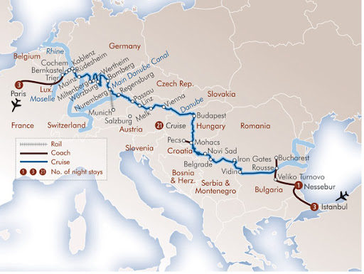
The photo shows our ship. We will have one of the cabins in the upper deck.
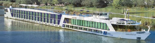
Click on this link to see our itinerary. Day 1 is Thursday May 29th.
While we are away I will be using my the GMAIL account: stespe1@gmail.com.
After a stopover at Dubai, we arrive in Paris at 1:30 pm Wednesday (Paris time) which is 3:30 am Thursday Melbourne time.
In Paris we will meet Philip, Hayley and Jeremy as well as Philip's friend Beverley and her two boys George and Jack.
We will have 31/2 days in Paris before taking a bus to Trier, via Luxembourg. In Trier we will board a boat and cruise to Bulgaria via the following waterways: Moselle River, Rhine River, Main River, Main-Danube Canal and Danube River.
The map below shows the route we will take. Click on it and a larger and clearer version will appear in a new page or tab. (Ignore the planes, we start at Paris and end at Istanbul.)
The photo shows our ship. We will have one of the cabins in the upper deck.
Click on this link to see our itinerary. Day 1 is Thursday May 29th.
While we are away I will be using my the GMAIL account: stespe1@gmail.com.
Thursday, August 9, 2007
Travel Plans
We have booked three separate holidays for 2008.
The first is in February, where we will spend a week at Philip Island, at one of our timeshare resorts.
UPDATE:
Here is the post on Philip Island.
In late May we will head to Europe for a 30 day tour. It will start in Paris and end in Istanbul. We will have four nights in Paris (where we hope to meet Philip) before heading by coach to Trier. There we will board a river cruise ship illustrated below. We wi ll travel down the Moselle, Rhine, Main and Danube rivers. Cities we will visit include: Heidelberg, Frankfurt, Wurzburg, Munich, Nurembrug, Salzburg, Passau, Vienna, Budapest, Belgrade, Bucharest and Istanbul. The travel company is APT. We can't wait.
In late August we will fly to New Zealand, for an 18 day Coach and Rail tour. The trip will finish in Christchurch just in time for Probus Rendezvous 2008. If you don't know what Rendezvous is then see the posts on Rendezvous 2007 on the Gold Coast which we visited this year.
The first is in February, where we will spend a week at Philip Island, at one of our timeshare resorts.
UPDATE:
Here is the post on Philip Island.
In late May we will head to Europe for a 30 day tour. It will start in Paris and end in Istanbul. We will have four nights in Paris (where we hope to meet Philip) before heading by coach to Trier. There we will board a river cruise ship illustrated below. We wi
 ll travel down the Moselle, Rhine, Main and Danube rivers. Cities we will visit include: Heidelberg, Frankfurt, Wurzburg, Munich, Nurembrug, Salzburg, Passau, Vienna, Budapest, Belgrade, Bucharest and Istanbul. The travel company is APT. We can't wait.
In late August we will fly to New Zealand, for an 18 day Coach and Rail tour. The trip will finish in Christchurch just in time for Probus Rendezvous 2008. If you don't know what Rendezvous is then see the posts on Rendezvous 2007 on the Gold Coast which we visited this year.
Subscribe to:
Posts (Atom)